
Westby
The area around Westby reservoir seem to offer many potential digs. If the OS maps are right then the Roman Road/Danes Pad should cut across and underneath the reservoir. Analysis of the LIDAR for the area fails to show any obvious road - but you never know. Some initial ground work has been carried out either side of the reservoir but permission to dig has yet to be acquired.
Some background information is contained in the following article written by R. Sharpe France in 1945 and published by the Historic Society of Lancashire & Cheshire.
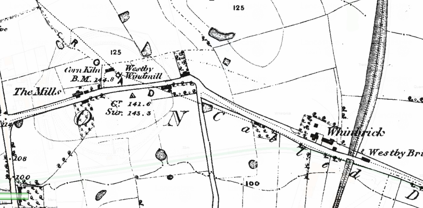
In 1912 the Fylde Water Board had obtained an important Act which enabled them to make very large new reservoirs in the hills of the Forest of Bowland, and this scheme entailed the erections of a compensation reservoir at Westby, where the land reaches a height of 100 feet. The site chosen was the point where the road to Blackpool took a turn to the left and where the Clifton Arms Inn and several cottages - of the two windmills which had once stood there, the survivor was burned down about 1873. The act provided that the necessary diversion should be paid for by the Fylde water board, and when completed should be handed over to the County Council. In practice the County Council did the work, and the Water Board paid. The work commenced in April, 1913, and completed in July, 1915. To the east there is still a length between its original hedges, about 12 feet wide; while to the west its track can be seen winding down, through the Hell Hole, and up the hill towards the reservoir. To the east of the Weeton road a small length of the original road remains, with the Westby Catholic church by its side.
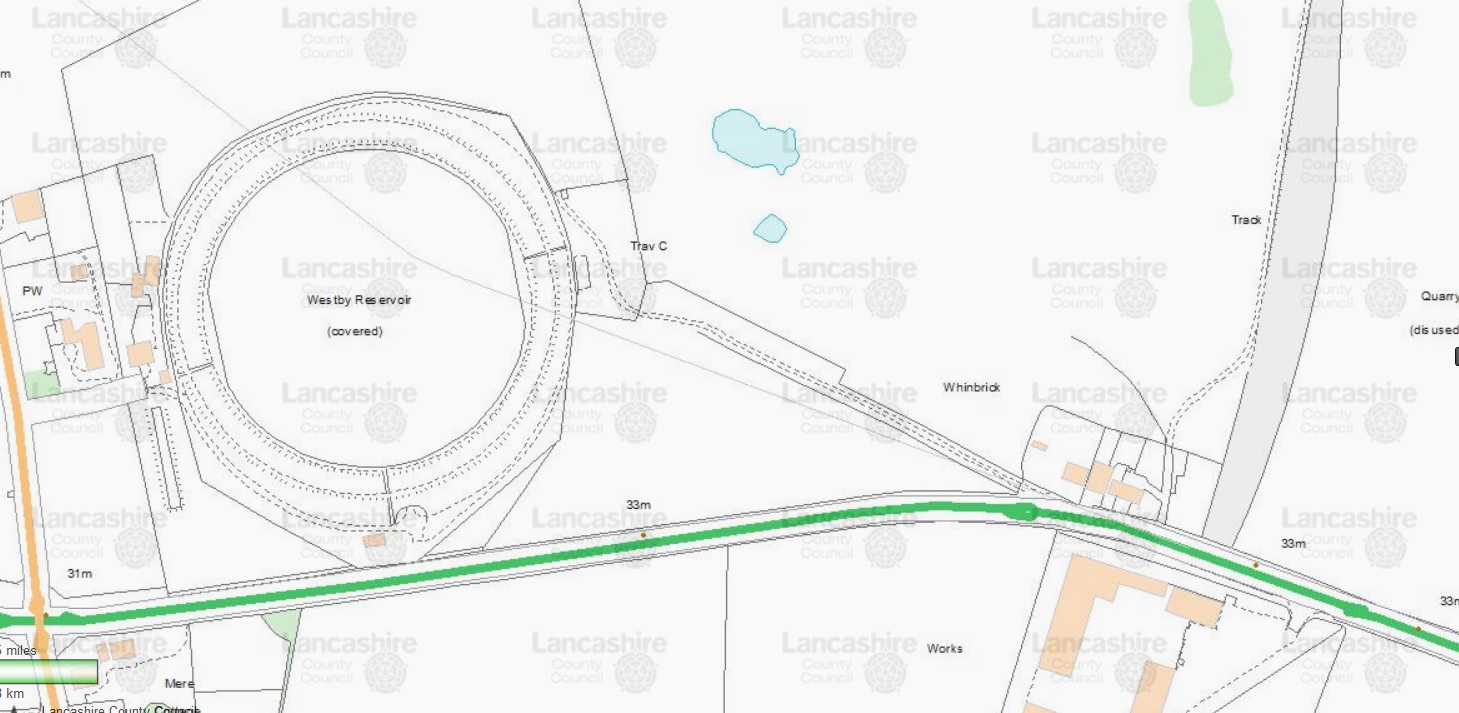
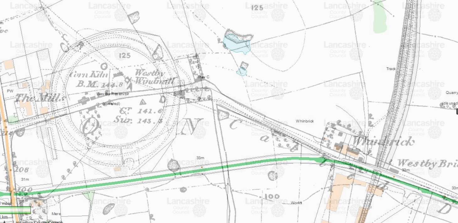
The three maps below show the same area pre-reservoir, the present day and, finally, and a mixture of both to show the relevant landmarks.
Some extra information can be found in the first part of the Danes Pad section - above in the menu.