
Map 1 The Over-Wyre Area: 1st. to 5th. Centuries AD
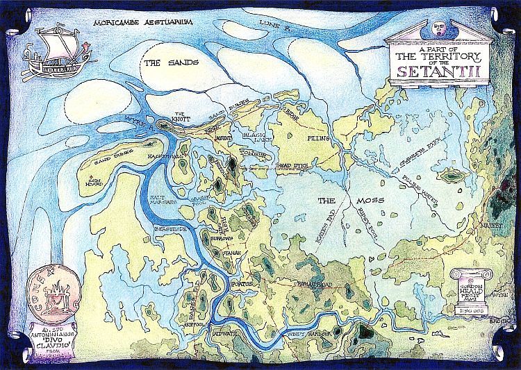
The basic premise of this map is that little or no man-made sea defences existed at that time and given that highest astronomical tide at the present day is +5.4 metres OD., then everything below the 5 metre contour belonged to the sea rather than the land, especially since there is evidence that sea level may have been as much as 1 metre higher than at present. When areas of Moss are added in, the result is that Over-Wyre becomes a series of small islands of dry land, basically the glacial drumlins such as Preesall Hill, the Great Knott, etc., surrounded by water and marsh.
There is also evidence that the Wyre ran out to the west just north of the present coastline, reinforcing the idea that any kind of seaport must have been upriver rather than offshore, probably at the highest navigable point of the Wyre which happens to coincide with the lowest crossing point and communications hub.
When the known Roman and earlier settlements and communications are superimposed on the topography proposed above, the fit is very striking: the Roman road from Nateby to Skippool could not have followed any other route and the logic of the position of Kate's Pad as a link across the moss is immediately obvious. Other examples are equally convincing as are later developments (some shown on the map) which occupy and connect areas of higher ground above flood level.