
Map 3 Preesall with Hackinsall
Preesall was first mentioned in Domesday as one of a number of vills belonging to Earl Tosti, 16 of which were inhabited, the rest waste. It had 6 carucates of land , number of inhabitants unknown.
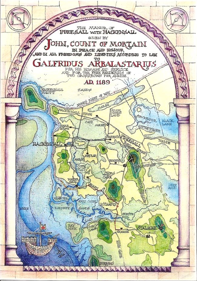
John, Count of Mortain, later King, toured the country dispensing justice and exacting fines; backed up by his enforcers, a notorious band of crossbowmen, one of whom, Galfridus (Geoffrey) was rewarded for his services in 1189 AD with the Lordship of the manor of Preesall with Hackinsall.
During his Lordship and that of his descendants many grants of land were made to monasteries, in particular to the newly founded Premonstratensian Abbey of Cockersand, the precise descriptions of their nature, boundaries and location in relation to topographical features and other landholdings being preserved in the chartulary of that Abbey. Tantalisingly few can now be identified but some have survived in the form of field, lane and farm names. Thus we know the location of Adam Cook's land, of Medlar, Clod's Carr, Cote Flat, Stanifurlong and the Oreste Pool. The Tongue, a gravel ridge once an ancient beach, is still delineated precisely by the 5 metre contour, and to its north lay the Black Lake, drained by the long disappeared Stockenpool.
The monks were granted a right of way from Pilling, skirting round the shores of Preesall and Hackinsall, to the High Road to the south. Its description in parts, ie. "by the sands below the bank", implies some form of sea defences, and the location of Geoffrey's mill, in a position in which it was most likely to be a tide mill, also implies the construction of embankments. The southernmost end of that right of way is called Monk's Lane to this day.
The monks were extremely industrious and it was they who began the process of the embanking, ditching and draining of Over-Wyre which was only completed in the 19th. century.