
Map 11 Parrox Hall Demesne circa 1840 AD
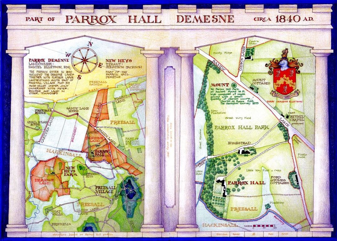
The first documentary evidence for a dwelling at Parrox is found in the 15th. century, although it is likely that the site, an area of well drained relatively higher ground bounded to the south by the Hackinsall watercourse, was occupied from a much earlier date. It appears to have been one of the four quarters into which the Hackinsall Lordship and Estate was divided in the late middle ages when the successor of Geoffrey the Crossbowman produced four daughters and no sons. Curiously the other three quarters have been gradually reunited down the ages and one person is now the three quarter Lord of the Manor of Hackinsall whilst the present occupier of Parrox still holds the remaining quarter by direct descent.
The Tithe Maps show that in the 19th. century the Parrox Demesne Lands, being the lands most closely associated with the Hall, were entirely contained within Preesall and the property boundary very closely followed the boundary between Preesall and Hackinsall, along the banks of the watercourse. The lands at Parrox and New Heys, both described as part of the demesne, are both good land entirely in Preesall separated by a strip of low lying marshy ground, a part of Hackinsall which extends as far as the foot of Preesall hill. It is possible that this configuration dates back to the original division of the Manor into four parts.
It was noted in the commentary on the Government Geological Survey of 1875, by Charles de Rance, that 'at Parrox Hall Park an ancient mound 16 ft. high composed of made ground with a small quantity of charcoal occurs'. This mound, known as the Mount, now capped by the local war memorial, is probably an ancient burial mound, the charcoal suggesting a possible cremation site.