
Bilsborrow - Roman Road
It's well known that a Roman road linked the Roman military depot at Walton le Dale (now under the Capitol Centre) with the important Roman fort at Lancaster. Another road must have connected Lancaster with the fort at Ribchester. Most experts, including those of the Ordnance Survey have theorised that this route lay over Longridge Fell or Beacon Fell approaching Galgate from the direction of the village of Street. The latest Wyre Archaeology dig now provides another possibilty; via Garstang.
A two day excavation, on the 11th and 12th August, 2019, seems to have solved this puzzle that has foxed antiquarians, cartographers and archaeologists alike for around 200 years. In a farmer's field near Bilsborrow a remarkably well-preserved 8m wide section of the 2000 year old road was exposed. This possible Roman road route was revealed by David Ratledge's analysis of the Environment Agency's LIDAR surveys. He was reasonably certain of the route taken by this missing link road and had previously visited a promising site where test pits had increased his conviction but to verify the discovery would need an archaeological investigation to confirm the existence or survival of the road under the modern ground surface.
David asked his colleagues in Wyre Archaeology to organise a dig and an approach was made to a local farmer who was happy to let Wyre Archaeology go ahead between when his crop was harvested and his winter seed was sown. This gave the team a very narrow window to carry out the dig. The findings include:-
- Road surface approximately 300mm below surface.
- North side of trench, road had been disturbed by field drain – south side undisturbed/pristine.
- Road width: approx 8 metres.
- Road cambered.
- Ditches not obvious.
- Road material: river gravel/stone (almost certainly from the River Brock).
- Road built on original clay – no dark humus layer so turfs/topsoil had been removed first.
- Surviving road 500mm thick at centre.
- Bottom layer: larger stones (c. 200mm size) had been laid on clay surface.
- Subsequent layers: gravel sizes 25mm to 150mm mixed.
For the first time drone technology was used to record the site.
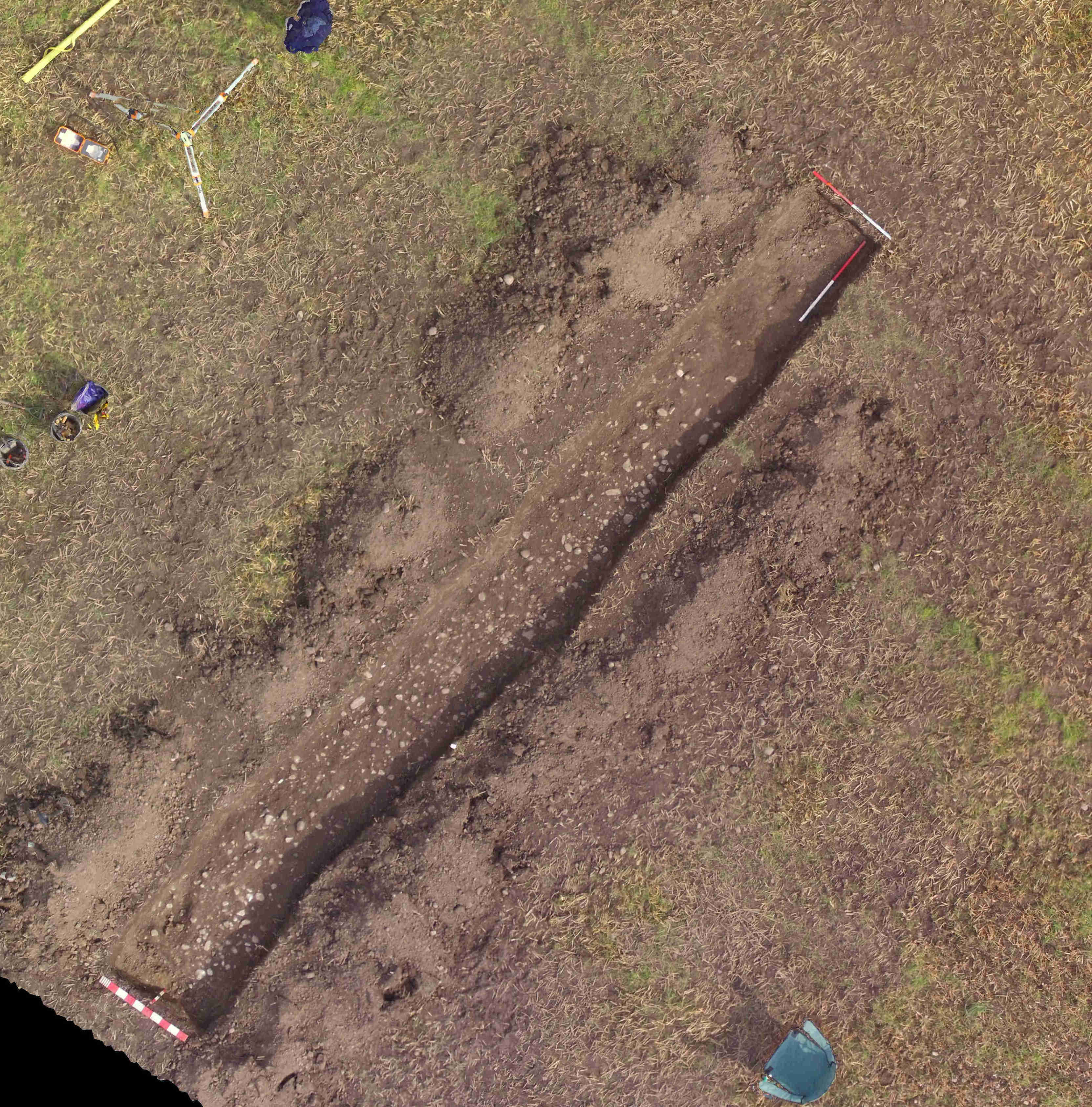
The above image shows the site at the end of day 1.
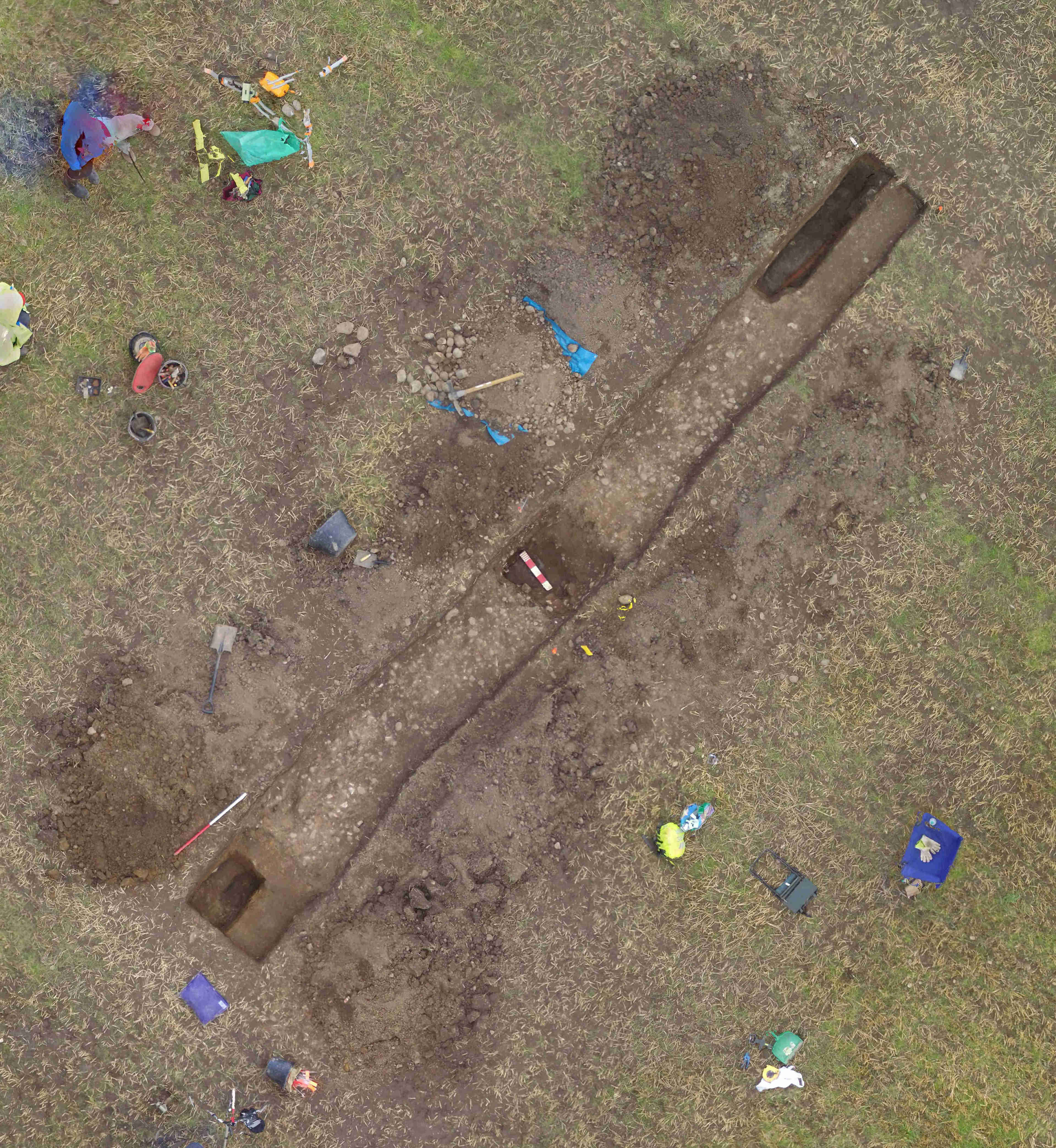
By the end of day 2, the top of the camber has been exposed and its depth investigated. Potential ditches at the ends of the road revealed very little at the northern (left-hand) end and a field drain at the southern (right-hand) end.
The images (courtesy of Chris Drabble, Wyre Archaeology) can be downloaded into your own software to reveal more detailed features.
Further images will be posted after analysis.
A more complete report for members can be found here.