The "First" Tram Road
Preston's "Tram Bridge" has been in the news recently when it was condemned as being unsafe. Many Prestonians will have fond memories of wandering through Avenham and Miller parks, over the bridge and then up the old tram road. This document is intended to show that this may not have been the original tram road and that another, earlier, tram road was planned and may well have been put into operation.
Tram Bridge & Tram Road
On the 22nd November, 1797 a section of the Lancaster Canal between Preston and Lancaster was opened to traffic - or so the story goes. As we will see, this comment needs a little more investigation for several reasons which we will come to eventually but, for the moment, we need to look at the reasons for the construction of the canal and some of the issues that it had to overcome.
The industrial developments in the late 18th Century resulted in an explosion of canal building linking manufacturing areas with their markets. The Lancaster Canal project, particularly, revolves around coal, extracted from the Wigan coal fields, being required in Preston, Garstang, Lancaster and Kendal with limestone being carried in the opposite direction. The lime produced from it used to spread on the land or in the building industry. The colours of the main cargoes gave rise to the moniker "Black and White canal". The image below shows the canal in 1817 along with the geography of this part of Lancashire and the geographical obstacles that needed to be overcome.
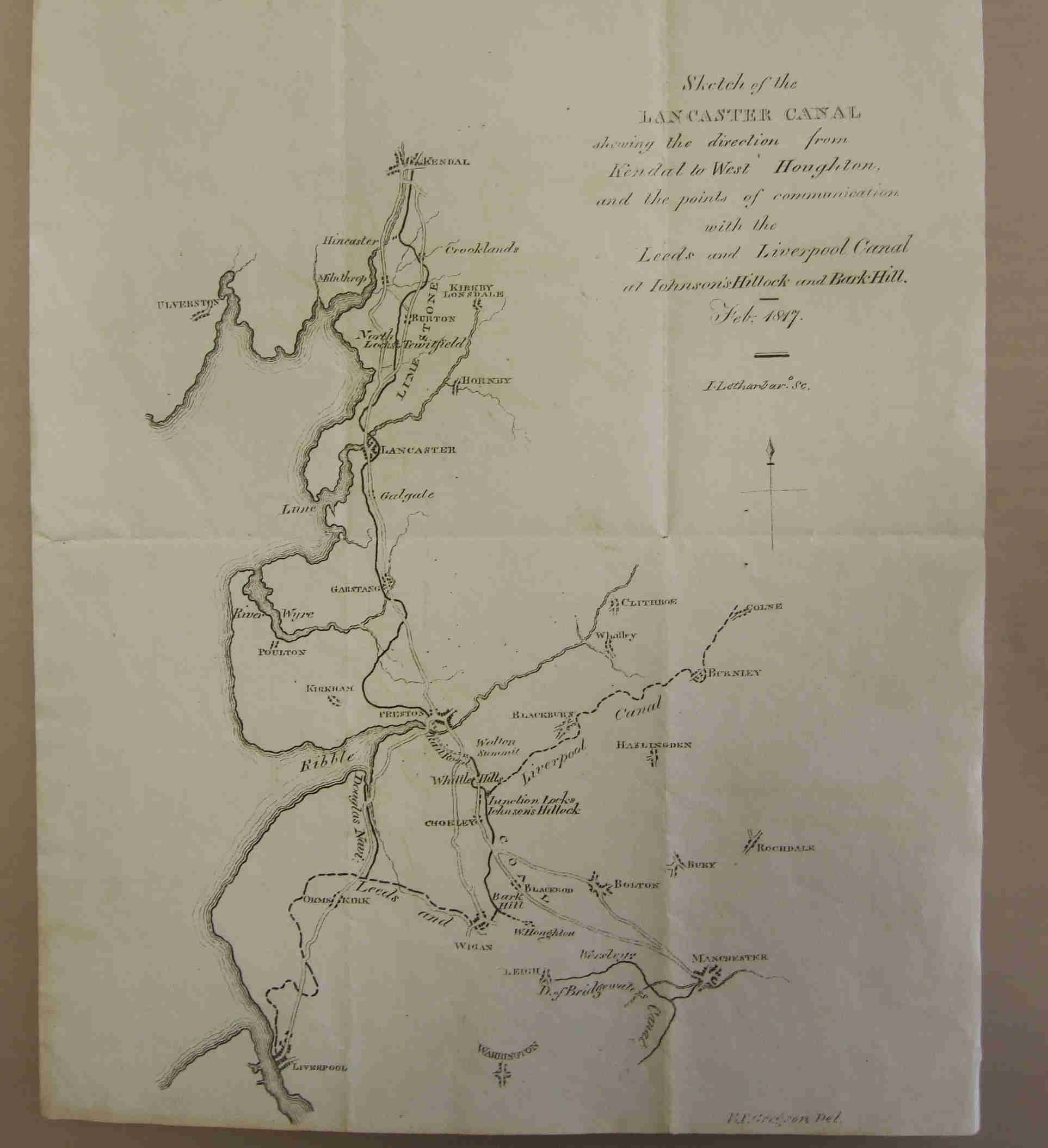
1817 Plan of the L:ancaster Canal
Coal had been extracted from the Wigan area since Roman times but transport had always been a problem; moving it from where it was mined to where it was to be used. The condition of the late 18th century roads meant that little coal was transported this way and, what was, was expensive. Thomas Steers, who was an 18th century engineer and surveyor, decided to look at alternative route; the River Douglas which runs from near Wigan down to the Ribble estuary. He suggested that the river be canalised in places so that it was improved for freight traffic. By 1720 coal demand had increased in the nearby towns (without any commensurate improvements in the roads) so an Act of Parliament was passed to allow the improvement of the River Douglas (also known as the River Asland) using many of Steers suggestions. Some limited improvements took place over the next 50 years but it was only when the river/canal system was bought by the Leeds and Liverpool Canal Company in the 1770's was real progress made.
As far back as 1772 investors got together to employ Robert Whitworth to survey a route between the Wigan coal fields and Kendal. He came up with two proposals; a lower and a higher route. The lower route would involve more locks going down to the Ribble and then back up again; the higher route needed a more expensive aqueduct. Although neither of these routes were ever put into operation they did provide the basis of the canal survey was carried out by John Rennie in 1792. For the Preston to Lancaster section Rennie also adopted a "contour" approach whereby locks were avoided by contouring around landscape. Built-up embankments or cuts were used to counter any undulations in the landscape but this also caused issues with leaks and subsidence. These, however, were small compared to the expense of crossing rivers Ribble, Wyre and Lune. The Wyre was relatively easily overcome with the aqueduct just south of Garstang. The Lune bridge and and its associated aqueduct cost more money than was expected so little was left in the kitty for the crossing of the Ribble. The solution was to have, unlike over the Lune, a relatively low bridge across the Ribble that would take coal laden tram road trucks from Walton Summit into Preston and thence onto the canal "proper". The difficulty with this being that the tram bridge was only completed in 1804 and so this route could not have been used to transport coal when the first canal barges travelled from Preston to Lancaster in 1797.
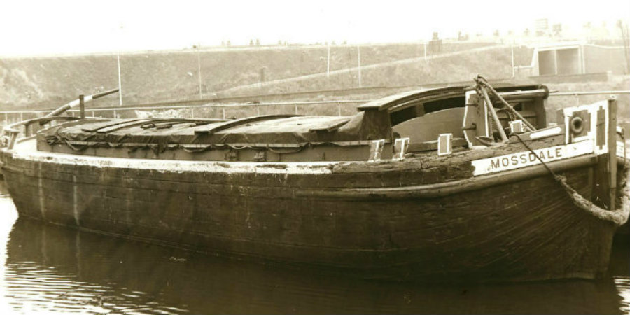
The first stage, in moving the coal down the Douglas, would have been to transfer the coal onto "coal flats". The National Canal Museum at Ellesmere has a "Mersey flat" dating from the 1850's (see below) that something similar, would have been used to transport coal down the Douglas. In the "Lancashire Local Historian - No 16" there is an article covering the development of the Douglas which contains the surprising information that the original flats were hauled by men - not horses - at least in the early days and they were paid between 8d and 12d a day. The coal could then be transferred to a more stable boat for the journey across or along the Ribble but, as we have seen with the development of the Ribble/Millennium link, at slack tide conventional barges or flats could still be used. In one the General Meetings in 1797 for the Lancaster Canal Company3 it was mentioned that some of the Douglas navigation boats could carry about 30 tons each and but could only go up the river at spring tides - so there are limitations in this method. Some idea of the charges can be gleaned from an agreement in 1754 where the charge was one shilling for every ton of coal, cannel*, limestone & stone transported down the Douglas and this agreement was in place for the next 21 years - a sign that no-one expected rapid inflation in the mid 18th century. Barritt quotes a ton of coal delivered to Preston would be 6s 6d; Garstang 7s 8d, Lancaster 8s and Kendal 11s. So money was to be made by reducing these costs by means of a canal.
*cannel coal was a coal that burnt very brightly - Wigan was famous for it.
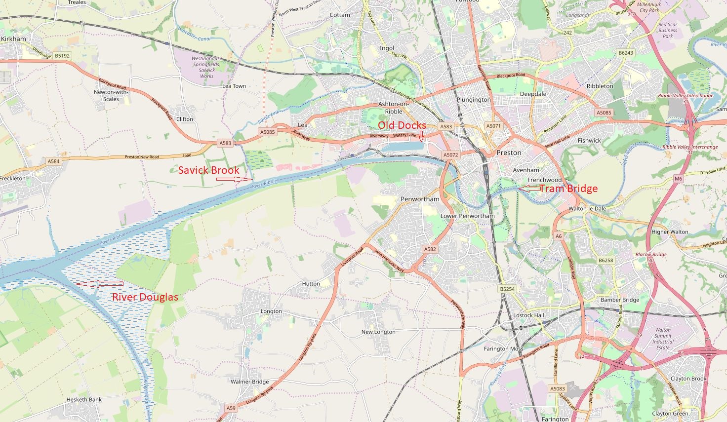
The alternative method of connecting Wigan with Preston, and the one ultimately implemented by the Lancaster Canal Company involved the construction of a canal from the edge of Wigan, through to Johnson Hillock and on to Walton summit. From there a tram road would run down to the River Ribble and over the tram road bridge. A powerful steam engine then lifted the coal trucks up to a higher level where they finally ran down to the main wharves in Preston. As far as the first coal barges coming from Preston are concerned there is one main problem - the tram road bridge was only implemented in 1804 - several years later than the first barges going into Lancaster. Coal transported by the conventional road network, even in the late 18th Century, would have been extremely expensive so we need to go back to investigate the use of the Douglas for getting coal into Preston. The map below shows the various areas of interest within this article.
Prior to the canal being completed to the north-west of Preston most of the river traffic was berthed in the dock to the south-west of Watery lane - close to where the Old Dock Office can now be found. Goods would then be transported either via Watery lane, Water lane, Fylde Road and into town or along the side of the marsh onto, what is now, Marsh lane and hence into town. Presumably the positioning of these wharves/docks would have been a compromise between being close to the centre of Preston, the depth of the water and the tide levels. The further you go upstream the more difficult it would be to get the depth of water required for shipping.
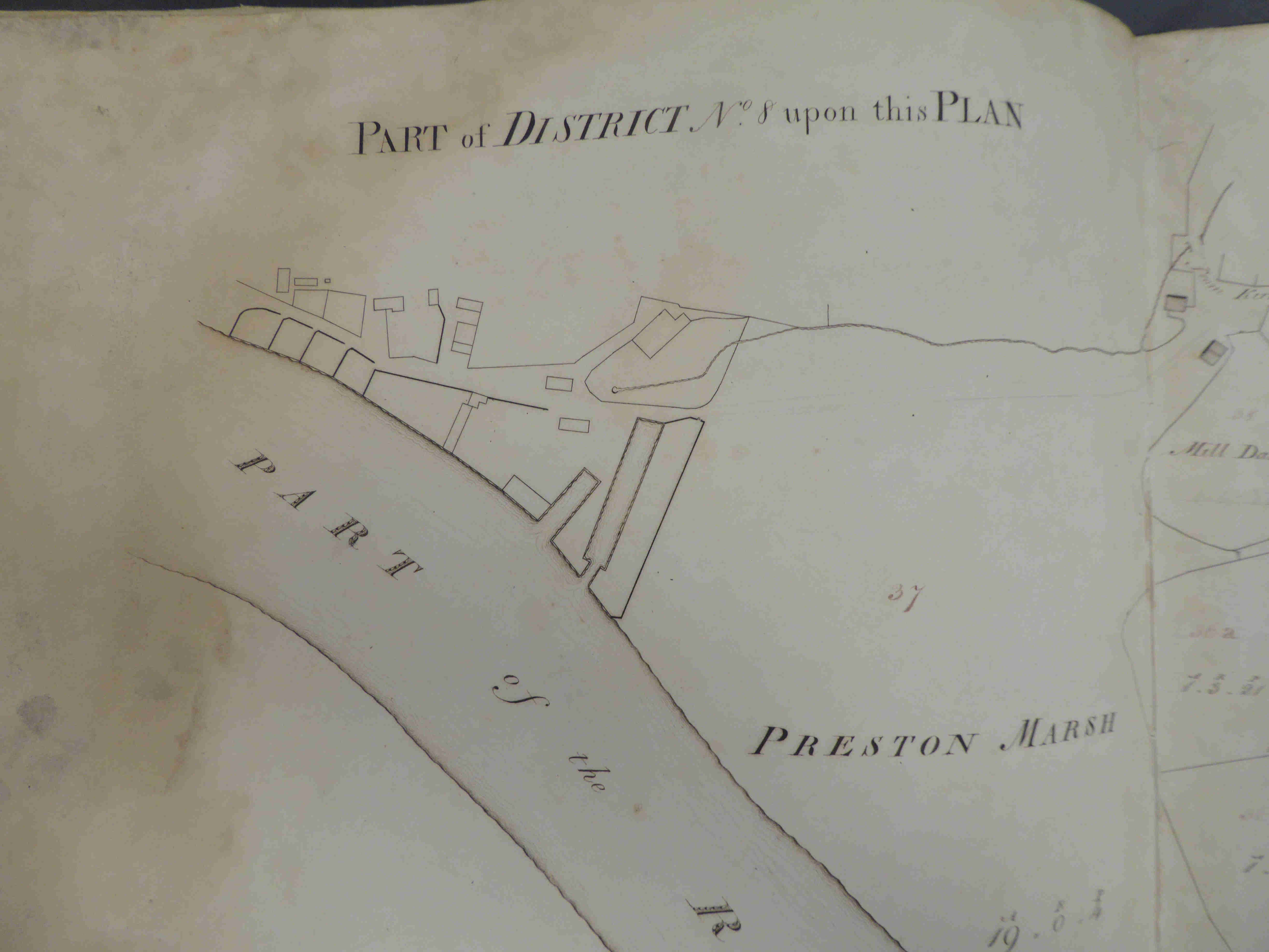
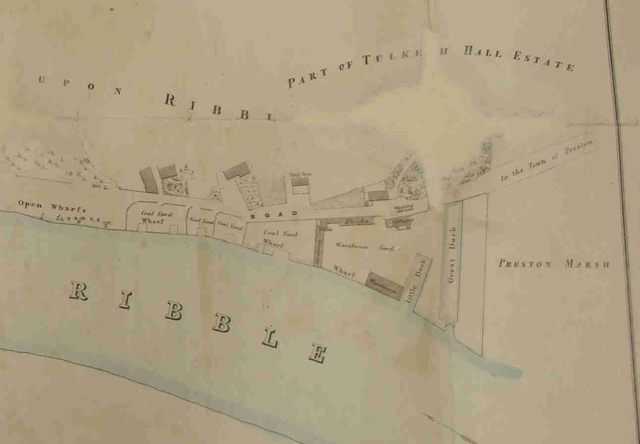
Shakeshaft's map of 1808/9 shows the basic structure of the Preston marsh dock area without giving too much detail. The map of 1838 below shows the docks, wharves, cranes, warehouses and even a custom house. Nothing comparable appears further up river.
Back to 1797. By this stage most of the Fylde portion of the canal was complete and was making progress into Preston and the route, described above, was more than likely the route to move coal from the dock to the canal. This was explained by the resident engineer, William Cartwright, in the Canal Company General meeting of 2nd July, 1799. He said that coal
was brought down the Douglas navigation (subject to all the additional expenses of freight and tonnage duty on another canal), and from thence the boats come up the river during tide time, where they are discharged at Preston marsh, and the coals are carted up to this canal.
he later adds
railroads have been found, by experience, to answer every purpose of conveying goods cheaply and expeditiously
Coal had been transported from Stanley, County Durham down to the Tyne by railroads4 for nearly three-quarters of a century so the technology and economics were well understood.
The Lancaster Canal Company General Meeting for 1797 contains a reference that the boats started at Spittle moss for the journey up to Lancaster. Spittle moss was an area either side of Fylde road near the present Guild pub and closer along the canal to the town centre. Along that section of canal could be found Green Bank wharves but it contained no docks or even basins for turning around the barges. But this starting point seems unlikely since Cartwright, several months later on the 2nd March, 1798 in a letter to his employers states:-
The canal thro’ Tulketh Hill I hope will be navigable to the Bason in about a month from this line….[he needs to] give directions for providing the materials for making the stages & landing places at the bason for the trade - and also gravel or stones for the road and whart(wharf) ought to be provided as well as the road forming
The two statements can't both be true. Cartwright, being the person on the ground, you would suspect, should provide the definitive answer but it also means that an alternative route for transporting coal onto the canal is needed. Perhaps the quote from the General Meeting is to keep shareholders happy. Other documents for the sale of the land around the basin and the area to the north of Fylde road to the Canal Company show these were only signed in August 1797. An even greater argument against the Spittle moss route can be seen in the fact that Preston Borough only sold off the land to the Canal Company in 1802.
Again, later on the 10th August 1798, Cartwright describes another problem:-
Deep cutting at Tulketh Hill on the offside the canal north of Cross’s Bridge a very large slip appeared a few days ago
Which implies problems still existed with this area of the canal. Revenue would soon be affected if this was the only route for transporting coal to the canal and alternatives were needed.
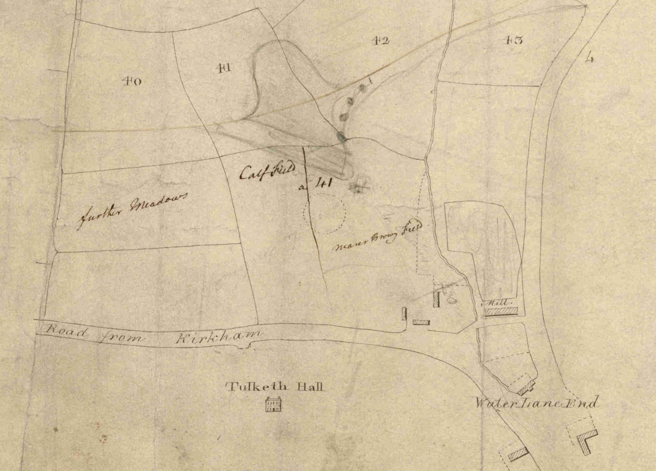
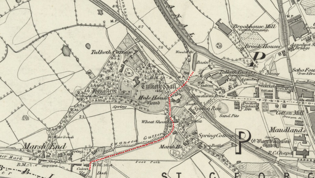
The present canal ends close to a dock basin at the back of Tulketh brow and, even though none of the records appear to mention this, this was also the obvious place for loading to take place, barges to be moored and still be reasonably close to the river dock. And it backs up Cartwright's assertion that "coals are carted up to this canal." The longer route, onto Spittle moss, was impossible as we will see later. This basin was most probably the one referred to by Cartwright above.
The main dock(s) at this time were still by the side of the river, as shown in the map below. Shakeshaft's map of 1808 shows the whole of the river going through Preston but the only place docks are mentioned are by the side of the river in Ashton. The most obvious route from the Ribble docks would follow the continuation of Watery lane along the side of Swansea gutter up to the old Wheatsheaf pub. From here there appears to be two possible routes. The shortest, but with the steepest incline, would be up Bray street, right onto Wyre street (which appears to have no other reason for being there and doesn't appear on any earlier maps) and then across Tulketh brow onto the dock basin (shown on the map below.) The alternative, with a lesser incline, would have been to continue up Watery lane to the junction with Fylde road and then left up Tulketh brow. Unfortunately this route is slightly longer.
According to Barritt, when commenting about the tram road south of the Ribble, he says
that two horses were expected to pull six wagons fully laden with coal (2 tons) from Clayton Green to Preston and return with limestone within 4 hours.
The route, shown above, was only 0.9km and a goodly portion of this along the flat so transporting the coal this way shouldn't have been a problem.
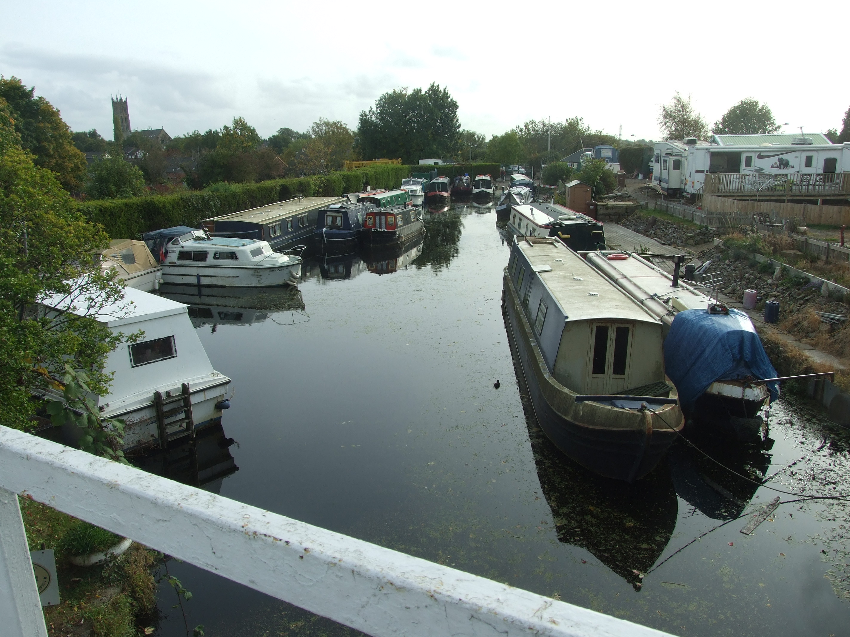
Modern view of the basin
Following Cartwright's earlier comment, it may well be that some form of rail track was used to help the movement of the coal and this was no doubt used prior to the combination of tram road/tram bridge being used from about 1805 onwards.
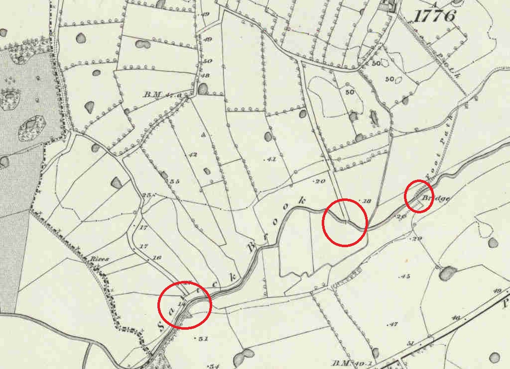
There is, fortunately, an alternative that uses Savick brook (or Savok brook as it is named in a number of the old records) as a way of getting coal flats close to the canal. This route has been rejected by modern scholars on the grounds that the brook wasn't and never has been navigable. A map, from 1756, show one of the channels of the Ribble passing further to the north. The dwelling, labelled "Fish House" is probably the modern Savick Brook Farm.
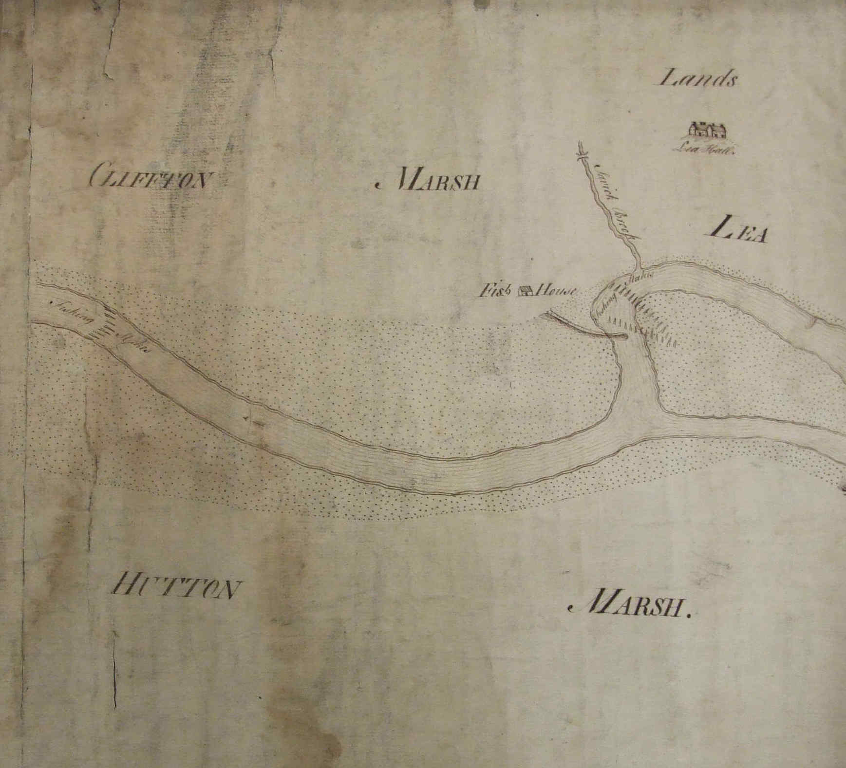
By permission Lancashire Evening Post & Lancashire Archives (DDPR 144/7)
It has been suggested that only with the development of the Ribble/Millennium link was the depth of water increased to allow barges to move freely. The other argument against this route was that the distance from the brook to the canal was greater than the Preston marsh route. To counter the first of these arguments there is a map, created in 1781 when the toll bridge onto Clifton marsh was proposed, which shows a vessel going up the brook - so it was navigable. The various OS maps give an upper high-water level to which any vessel could travel so, probably to give some leeway on berthing.
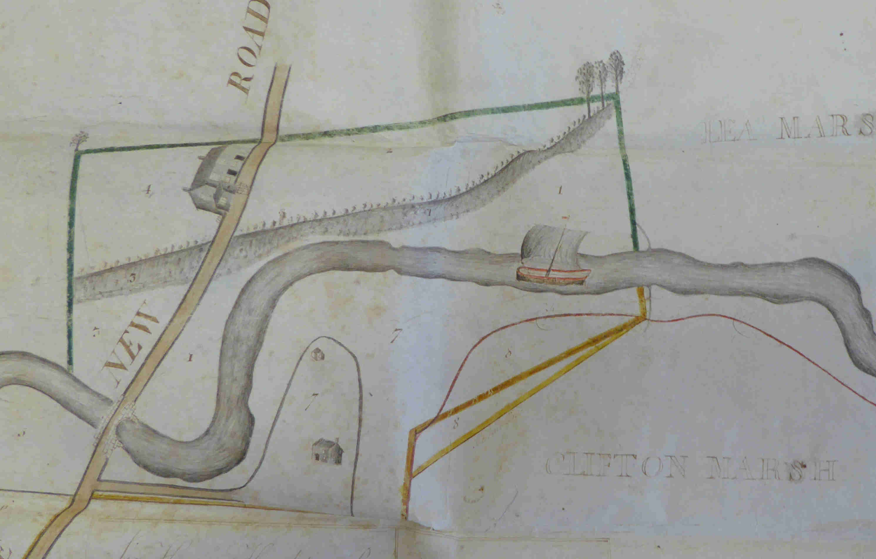
5By permission of J C Hilton Lord of the Manor of Lytham - DDCL/583
Looking in more detail into the toll bridge agreement between the Hoghtons and Cliftons we see
[the parties] have agreed to throw into common certain quantities of land on each side the said River Salwick otherwise Savick to be appropriated for the making of Wharfs timber and coal yards and for such other uses and purposes as they shall mutually agree upon5
So there was a view that Savick brook could, at some time in the future, be used for more commercial uses.
Dated 12th July, 1792 the Clifton family produced a notice reminding users that there should be no trespassing over Clifton Marsh - perhaps this was a way of preempting the Lancaster Canal Company or, perhaps, a bargaining chip.
To all Owners and Captains of Vessels, Navigating up the River Ribble, and all others whom it may concern.
Whereas Vessels are frequently unloaded at Clifton Caul, and the Goods and Things taken from such Vessels, carted over the Marsh, whereby much damage is done thereto, to the Herbage and Soil of John Clifton, Esq. NOTICE is therefore hereby GIVEN, That if any Person or Persons shall hereafter unload any Vessel upon any part of Clifton Marsh, or cart any Goods over any Part thereof, (without first having obtained the consent of James Gradwell of Clifton, who is authorized by Mr Clifton, to give Leave at particular Times, under certain Circumstances, and subject to Terms and Regulations) he and they will be prosecuted as a wilful Trespasser and wilful Trespassers.
Secondly, there appears to be at least three "green lanes" working their way north from the brook towards the canal. Possibly one of the lanes could have been a private route from Lea Hall to Lea town since there is a bridge over the brook. Another could, possibly, be a route to a mill or something similar but three routes seems to be overkill. On all of the available maps these lanes don't have any equivalent going south from the brook - which is a little strange - but it is the left hand route is the most intriguing since there is no bridge. Also, in the 1838 tithe map, this particular lane appears to have no owner and is now a public footpath.
The third point and the origin of this article can be traced back to a comment found when transcribing the Cragg family diary. The diary covers the thoughts and background of various generations of the Cragg family that lived for more than 100 years in Upper Wyresdale. The entry that stood out was
"Lancaster canal which was opened on the 22nd of November (1797) and since that time several large loads of coals and cannel have been brought to Lancaster and Galgate from Savok a little below Preston."
The Record Society of Lancashire & Cheshire, in Volume 142 contains an interesting article on the Cragg family - together with a full transcription of the diary. In it it is suggested that the word "Savok" is presumed to mean "Salwick, five miles west of Preston." This seems unlikely; the old maps and records often give the name "Savick" brook as "Savock/Savok".
So, at least, this track was proposed but was it put into execution? The Cragg diaries implies that it was.
There are further arguments in favour of the Savick/Savok route being implemented - at least as a temporary solution. William Cartwright, in his letters, recounts numerous breaches in the canal - the stabilising of the embankments at Tulketh and over Savick brook in Ashton were major problems - and these are on the Preston side of this Lea route. Also, as mentioned earlier, Cartwright describes that he hopes the basin (above Tulketh road) would be ready in about a months time. This being the 2nd March, 1798 - more than three months after barges had left from Preston.
Another point mentioned in one of the general meetings being the barges only having access to the Preston wharves at high tide. The further you go up the river the less the tidal range. Using that logic would imply that there would be a greater tidal range on the Savick - making it easier to unload the coal or even load up with limestone.
In "Canals of North West England" by Hadfield & Biddle6 there is a comment on page 189 stating that coal was "carted down to the Douglas and so taken that way to Preston; there it had to be labouriously carted again up to the North End". A further comment states "In 1796 and 1797 various proposals were considered for a short branch canal from Salwick or the North End to Savock followed by an inclined plane down to the Ribble or alternatively a tram road from the canal at Tulketh, the idea being to exchange traffic with the Douglas. The Leeds and Liverpool agreed to improve the Douglas but the Lancaster [Canal Company] was unable to finance their work." Hadfield & Biddle only treat this route as a "proposal". Perhaps the Cragg family diary entry elevates this idea above a proposal.
Yet another reason for choosing the Savok route was the distance between the Savok and the wharf in Ashton is a couple of kilometres - at least half an hour in time for the coal flats going up the Ribble. The return distance, along the canal, between the Tulketh Brow basin and Lea Town would be about 4 miles. All of this adds time to the journey.
In the De Hoghton7 records within Lancashire Archives (DDHO 486) there is an agreement for new road between Clifton & Lea which is "indemnified against charges for the purpose of wharfages, landing coal, limestones & other stone slate, timber...". It is dated 1/5/1781. It isn't obvious whether the wharfages refers to the Ribble, Savick Brook or both but, since the boundary between the Cliftons & Hoghtons runs along the brook, it is more than likely that any wharfages refers to Savick brook.
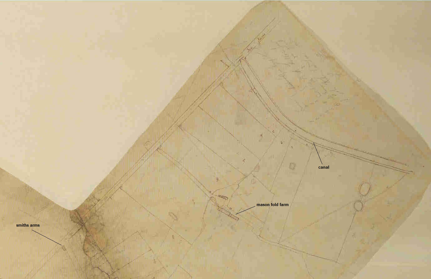
The last, and possibly most important, bit of evidence for Savick brook being used appears in a map produced for Lancaster Canal Company8 that covers the area between the Ribble and the canal at Lea Town. The focus of the map shows the track from the brook, onto Darkinson lane, through Lea and on to the canal. The first portion of the map shows the brook coming north from the Ribble, passing under, what is now Blackpool road, and onto the junction with the "green lane". All along the route the fields are numbered - presumably to tie in with the owners of the land that this route goes through and to provide compensation.
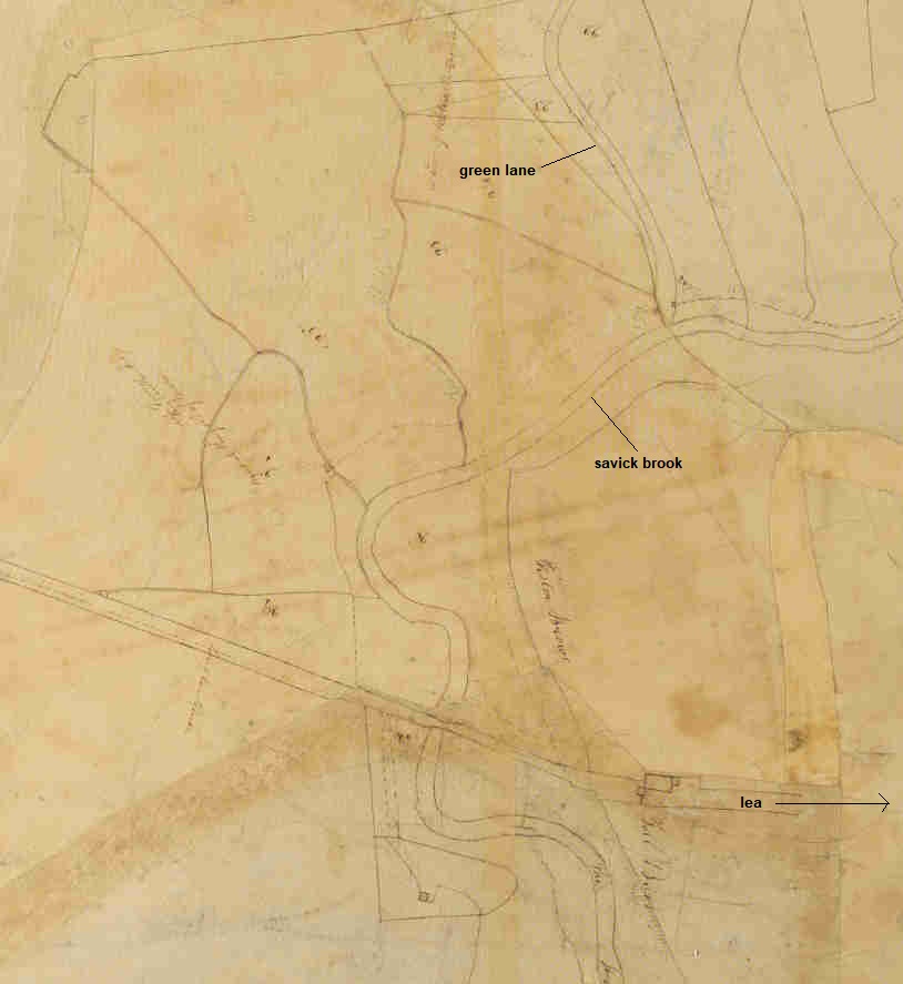
The high water level is shown on the OS maps some distance upstream from the confluence of the brook and the "green" lane.
The most northerly portion of the map takes the track up to the canal to the north of Lea town.
Now we come to the most important part. Zooming in on the section of the map nearest the canal end the words "rail ends" appears.
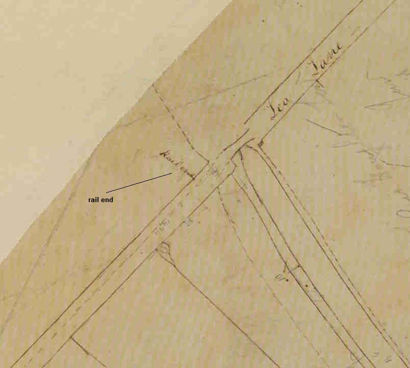
So, at the very least, this particular route was planned and, given the issues at the Preston end of the canal, seems to be the only solution. A rail track could have been inexpensively added and, even if it was never or infrequently used, could provide a back-up method of getting coal onto the canal. Within a few months the basin at Tulketh would have been completed and, given the infrastructure at the Preston marsh docks, would probably mean that that route would have been used until the wharves in the centre of Preston, the tram bridge and "new" tram way completed.
1. DDPR 144/9 - Lancashire Archives
2. "The Old Tram Road: Walton Summit to Preston Basin" by Steven Barritt
3. "Transcripts of Reports on Lancaster Canal 1790-1800" by R.W.G. Bryant. - Lancashire Archives
4. https://en.wikipedia.org/wiki/Causey_Arch
5. DDCL/583 - Lancashire Archives4.
6. "Canals of North West England" by Hadfield & Biddle
7. DDHO 486 - Houghton deeds - Lancashire Archives
8. RAIL 844/148 - Public Records Office
Addendum
After visiting the site where the "green" road meets Darkinson lane, I have some slight changes to the arguments drawn above.
1. The last map in the article, RAIL 844/148 must have been produced pre 1800 because, by this time, most of the canal from Preston to Lancaster would have been stabilized. There would have been no reason, apart from back-up, to produce a map for the Lea solution. As mentioned before, all the landowners either side of the track were shown but the green lane seems to show it WAS ALREADY IN EXISTENCE. So it had to be there for some other reason - possibly a track to a mill.
2. The track from the canal, following the modern path, goes up a slight slope to Darkinson lane. From there is goes quite steeply downhill for 100m. If the Canal Company were buying up land for their tramroad it would make more sense to contour around this slight hill.
I don't think the above points change any of the original conclusions. Coal did, indeed, flow from "Preston" to Lancaster in 1797 but not, as we have seen, from Spittle Moss. It had to be transferred to the canal somewhere to the West of Spittle Moss and the Tulketh embankment. Savick brook is the obvious answer - if only for a short period of time before the Preston Marsh connection was stabilized.
3. It has been pointed out that the basin above Tulketh road could also have been created to service the lime kilns. So which came first, the canal or the kilns? More research is required in this area. The earliest map showing the possible route of the canal (shown in pencil) into Preston (~1795) shows some uncertainty regarding the position of the basin. A circle of dots may, or may not, show the lime kilns. Hadfield & Biddle mention that in 1791 Samuel Gregson was appointed clerk to the Lancaster Canal Company. Possibly he used this position to form a company (Samuel Gregson & Co) to build limekilns along the route of the canal.